


Surveying the Byzantine Corinthia
- Feb 2, 2023
- 4 min read
This is a bit of random post that is made possibly by the generosity of my buddy Dave Pettegrew. Last week, I helped him put the final touches on an article that pulls apart the low density scatter of Byzantine pottery across the Corinth. I mostly added some footnotes that connected Dave’s thoughtful and critical analysis to the data upon which it rested.
I’m excited enough about this to share it here on the ole blog for three reasons. First, it is a great example of how to allow a reader to drill down into survey data from the “dizzying heights” of interpretation and analysis. Second, it shows how thoughtfully collected, organized, and published data can provide a meaningful supplement to published reports. Instead of having to reproduce drawings and maps from the project, you can link to dynamic expressing of these illustrations and plans and this allows a reader to explore the situations and forms in their own way. Finally, this practice encourages — or at tempts — the reader to reuse this data in different ways either on the granular level of artifacts or the aggregated level of regional or even transregional analysis. By showing that the data is there and revealing how it is organized, other scholars can at least theoretically reuse this data in a thoughtful way.
1. Contexts. One of the coolest things about the EKAS data is that it’s organized in such a way that it’s possible to get a sense for field conditions in particular area. This means, you can compare, for example, the number and distribution of ploughed and unploughed fields across the survey area. Or look for units on the basis of a particular visibility. And with a bit of persistence combine the two: these are ploughed fields with 30% visibility in a particular area. If you want a real deep dive, you can even look at the geomorphological data from the survey area.
2. Chronotypes. As readers of this blog know, the chronotype system was both a sampling strategy used by the survey as well as a naming convention that a number of other projects have since adopted. This allows us, for right now, to identify all the survey units were fragments of African Red Slip forms 104-106 appear or units that produced some of the few fragments of Early Medieval cooking pots. You can also drill down to see that Tim Gregory identified the two fragments of Early Medieval cooking pots 20 years ago (here and here) in survey unit DU 7612 and illustrated another example from the vicinity of Rachi Bossa in 2001.
3. Periods. It is not very hard to go from a particular chronotype, to material from a particular period. So here are all the “top order” chronotype periods from the survey area. Clicking on the Medieval chronotype period allows us to see all the material dated to that period and the various sub-period associated with this higher order period and the distribution of Medieval pottery in general. We can then, “dig deeper” to check out the distribution of Late Medieval material from the survey area. And we can look at all the specific example of Early Medieval pottery from the survey area. Or, this cute little fragment of an Ottoman/Venetian Sgraffito identified by Daniel Pullen in 2001 from the area of Perdikaria near Rachi Bossa.
4. Regions, Zones, and Sites. In some ways, the ability to present information collected in a granular way in a granular fashion is not all that remarkable. After all, projects have long released their data in various spreadsheets that allowed savvy scholars to understand what projects recorded.
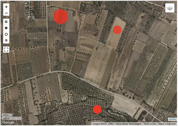
What’s more interesting is how we can aggregate data in interpretative meaningful ways. For example, David identified an early Medieval site on the slope of Mt. Oneion near a modern church dedicated to Ay. Paraskevi:
EMED 1: Ayia Paraskevi (Zone 38), on the lower slopes beneath Mt. Oneion, lay just above the road from Kenchreai about two kilometers west of the harbor. Early Medieval fine ware sherds were found in five (of ten) survey units covering an area of 220 x 220 meters. The eight rims, bases, and handles represent green and brown painted ware, measles ware, and glazed fine ware; three of these artifacts can be dated to the eleventh to twelfth century. The Early Medieval presence here reoccupies a probable Late Roman villa site inhabited at least into the seventh century.
We can check out the material from this area here and from “Zone 38” here and the Early Medieval artifacts from that area here and the Late Roman artifacts here.
David also identified some Late Medieval sites in the survey area. After acknowledging that the in general, the low density of Late Medieval material in the survey area belies its not insignificant quantity, he identified several low density sites.
For example:
LMED 11 (Zone 47). The site of Ano Vayia generated two fragments of Late Medieval coarse ware.
Once again, we can identify this site spatially by zone and by region. We can locate the two Late Medieval sherds from this zone. And then pull up the two artifacts: here and here. It’s useful to note that once again Tim Gregory identified this material in 2003 and that these two artifacts are available for restudy at Isthmia. It is also notable that we mentioned this material in a 2010 publication which you can check out here.
What David has done with this survey data isn’t particularly unique, but it does get exciting when we think about how this kind of granular and aggregated data can form the basis for both a book length publication on the project (coming soon!) as well as the reuse of the data by other interested scholars.


Comments