


The Armenians – The situation around 1000 BC
- Mar 21, 2013
- 30 min read
Hayasa-Azzi:

Hayasa-Azzi or Azzi-Hayasa was a Late Bronze Age confederation formed between two kingdoms of Anatolia, Hayasa located South of Trabzon and Azzi, located North of the Euphrates and to the South of Hayasa. The Hayasa-Azzi confederation were in conflict with the Hittite Empire in the 14th century BC, leading up to the collapse of Hatti around 1290 BC.
The similarity of the name Hayasa to the endonym of the Armenians, Hayk or Hay and the Armenian name for Armenia, Hayastan has prompted the suggestion that the Hayasa-Azzi confereration was involved in the Armenian ethnogenesis. The term Hayastan bears resemblance to the ancient Mesopotamian god Haya (ha-ià) and another western deity called Ebla Hayya, related to the god Ea (Enki or Enkil in Sumerian, Ea in Akkadian and Babylonian). Thus, the Great Soviet Encyclopedia of 1962 posited that the Armenians derive from a migration of Hayasa into Shupria in the 12th century BC.
Urartians:
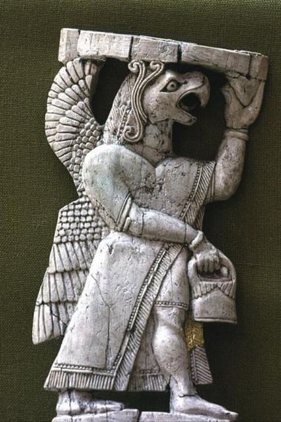
Urartians share mostly of their history together with the Hurrians, excepet that Urartians didn’t take part in the formation of the Hurrian Late Bronze Age kingdom of Mitanni, but continued their existence in states as Nairi (KUR.KUR Na-i-ri, also Na-’i-ru) and later Urartu (Armenian: Urartu, Assyrian: māt Urarṭu; Babylonian: Urashtu).
The name Urartu (Armenian: Urartu, Assyrian: māt Urarṭu; Babylonian: Urashtu), corresponding to Kingdom of Ararat or Kingdom of Van (Urartian: Biai, Biainili – from which is derived the Armenian toponym “Van”), comes from Assyrian sources.
The Assyrian King Shalmaneser I (1274–1245 BC or 1263–1234 BC) recorded a campaign in which he subdued the entire territory of “Uruatri” in 1274 BC. Uruartri itself was in the region centred around Lake Van in the Armenian Highlands.
The Shalmaneser text uses the name Uratri to refer to a geographical region, not a kingdom. The Assyrian inscriptions mention Uruartri as one of the states of Nairi which he conquered and names eight “lands” contained within Urartu (which at the time of the campaign were still disunited).
Shubria, also known as Subartu, was part of the Urartu confederation. Later, there is reference to a district in the area called Arme or Urme, which some scholars have linked to the name Armenia.
Strictly speaking, Urartu is the Assyrian term for a geographical region, while “kingdom of Urartu” or “Biainili lands” are terms used in modern historiography for the Iron Age state that arose in that region. The kingdom rose to power in the mid-9th century BC, but was conquered by Media in the early 6th century BC.
That a distinction should be made between the geographical and the political entity was already pointed out by König (1955). The landscape corresponds to the mountainous plateau between Asia Minor, Mesopotamia, and the Caucasus mountains, later known as the Armenian Highlands.
According to archaeological data farming on the territory of Urartu began to develop since the Neolithic period, even in the 3rd millennium BC. In Urartian age agriculture was well developed and closely related to the Assyrian on the selection of cultures and ways of processing.
Shupria:

Shupria (Shubria) or Arme-Shupria (Akkadian: Armani-Subartu from the 3rd millennium BC) was a Proto-Armenian kingdom, known from Assyrian sources beginning in the 13th century BC, located in the Armenian Highland, to the southwest of Lake Van, bordering on Ararat proper. Scholars have linked the district in the area called Arme or Armani, to the name Armenia.
Weidner interpreted textual evidence to indicate that after the Proto-Armenian (Hurrian) king Shattuara of Mitanni was defeated by Adad-nirari I of Assyria in the early 13th century BC, he then became ruler of a reduced vassal state known as Shubria or Subartu. The name Subartu (Sumerian: Shubur) for the region is attested much earlier, from the time of the earliest Mesopotamian records (mid 3rd millennium BC).
Shupria is mentioned in the letter of Esarhaddon to the god Assur. Esarhaddon undertook an expedition against Shupria in 674, subjugating it. Together with the Nairi the region fell under Urartu in the 9th century BC, and their descendants later contributed to the ethnogenesis of the early Armenians.
Nairi:
Nairi was the Assyrian name for a loose confederation of small Hurrian kingdoms and tribal states in Armenian Highland, roughly corresponding to the modern Van and Hakkâri provinces of modern Turkey, in the 13th–11th centuries BC. It was the successor of the state of Mitanni. Egyptian sources call Mitanni “nhrn”, which is usually pronounced as Naharin/Naharina from the Assyro-Akkadian word for “river”, cf. Aram-Naharaim.
During the Bronze Age collapse (13th to 12th centuries BC), the Nairi tribes were considered a force strong enough to contend with both Assyria and Hatti. The Battle of Nihriya, the culminating point of the hostilities between Hittites and Assyrians for control over the remnants of the former empire of Mitanni, took place there, circa 1230.
The names of twenty-three Nairi lands were recorded by Tiglath-Pileser I (1114–1076 BC). Their southernmost point was Tumme, known to have been south-west of Lake Urmia, and their northern one Daiaeni. It is believed that Nairi extended from the Tur-Abdin mountains in the south to the mountainous area southwest of Lake Van in the north.
The Nairi states were repeatedly subjected to further attacks and invasions by the Assyrians, especially under Tukulti-Ninurta I (c. 1240 BC), Tiglath-Pileser I (c. 1100 BC), Ashur-bel-kala (c. 1070 BC), Adad-nirari II (c. 900), Tukulti-Ninurta II (c. 890), and Ashurnasirpal II (883–859 BC).
Urartu:

The name Urartu (Armenian: Urartu, Assyrian: māt Urarṭu; Babylonian: Urashtu), corresponding to Kingdom of Ararat or Kingdom of Van (Urartian: Biai, Biainili – from which is derived the Armenian toponym “Van”), comes from Assyrian sources.
The Assyrian King Shalmaneser I (1274–1245 BC or 1263–1234 BC) recorded a campaign in which he subdued the entire territory of “Uruatri” in 1274 BC. Uruartri itself was in the region centred around Lake Van in the Armenian Highlands.
The Shalmaneser text uses the name Uratri to refer to a geographical region, not a kingdom. The Assyrian inscriptions mention Uruartri as one of the states of Nairi which he conquered and names eight “lands” contained within Urartu (which at the time of the campaign were still disunited).
Urartu re-emerged in Assyrian inscriptions in the 9th century BC as a powerful northern Iron Age rival of Assyria at the headwaters of the river Tigris. Living at the time of King Shalmaneser III of Assyria (ruled 859–824 BC), the Uratian king Arame (860–843 BC) united the Nairi states and tribes into one kingdom against the threat of the Assyrian Empire.
Arzashkun, the capital of the early kingdom of Urartu in the 9th century BC, had double walls and towers, and was hidden and protected from attack by a dense forest almost impassable to a regular army, but was captured by Shalmaneser III in the 840s BC.
Shalmaneser regarded the unification and establishment of the Urartian state as so menacing to Assyria’s interest that he undertook an expedition in 857, claimed to have destroyed the capital Arzashkun, penetrated as far as Lake Van, and left his inscription on Mount Irritia. In 832 BC Sarduri I moved the capital to Tushpa.
From cuneiform sources is known that in Urartu grew wheat, barley, sesame, millet and emmer, and cultivated gardens and vineyards. Many regions of the Urartu state required artificial irrigation, which has successfully been organized by the rulers of Urartu in the heyday of the state.
In several regions remain ancient irrigation canals, constructed by Urartu, mainly during the Argishti I (785-763 BC), who founded the citadel of Erebuni in 782 BC, which is the present capital of Armenia, Yerevan, and Menua (810-786 BC) period, some of them are still used for irrigation.
The economic structure of Urartu was similar to other states of the Ancient World, especially to Assyria. The state was heavily dependent on agriculture, which required a centralized effort to irrigation. These works managed by kings, in their implementation participated the free inhabitants, and perhaps the prisoners as slaves.
Royal governors, influent people and, perhaps, free peoples had their own allotments. Individual territories within the state had to pay taxes the central government in form of grain, horses, bulls, etc. In peacetime, Urartu probably led an active trade with Assyria, providing there cattle, horses, iron and wine.
With the expansion of Urartian territory, many of the gods worshiped by conquered peoples were incorporated into the Urartian pantheon, as a mean to confirm the annexation of territories and promote political stability. However, although the Urartians incorporated many deities into their pantheon, they appeared to be selective in their choices.
Although many different Urartian kings made conquests in the North, such as the Sevan region, many of those peoples’ gods remain excluded. This was most likely the case because Urartians considered the people in the North to be barbaric, and disliked their deities as much as they did them.
Good examples of incorporated deities however are the goddesses Bagvarti (Bagmashtu) and Selardi. On Mheri-Dur, or Meher-Tur (the “Gate of Mehr”), overlooking modern Van, an inscription lists a total of 79 deities, and what type of sacrificial offerings should be made to each; goats, sheep, cattle, and other animals served as the sacrificial offerings.
The pantheon was headed by a triad made up of Khaldi (the supreme god), Theispas (Teisheba) god of thunder and storms, as well as sometimes war, and Shivini a solar god. Their king was also the chief-priest or envoy of Khaldi. Some temples to Khaldi were part of the royal palace complex while others were independent structures.
Scholars such as Carl Friedrich Lehmann-Haupt (1910) believed that the people of Urartu called themselves Khaldini after their god Khaldi. The Nairi, an Iron Age people of the Van area, are sometimes considered related or identical.
In 714 BC, the Urartu kingdom suffered heavily from Cimmerian raids and the campaigns of Sargon II. The main temple at Mushashir was sacked, and the Urartian king Rusa I was crushingly defeated by Sargon II at Lake Urmia. He subsequently committed suicide in shame.
Rusa’s son Argishti II (714 – 685 BC) restored Urartu’s position against the Cimmerians, however it was no longer a threat to Assyria and peace was made with the new king of Assyria Sennacherib in 705 BC. This in turn helped Urartu enter a long period of development and prosperity, which continued through the reign of Argishti’s son Rusa II (685–645 BC).
After Rusa II, however, the Urartu grew weaker under constant attacks from Cimmerian and Scythian invaders. As a result it became dependent on Assyria, as evidenced by Rusa II’s son Sardur III (645–635 BC) referring to the Assyrian king Ashurbanipal as his “father.”
Late during the 600s BC (during or after Sardur III’s reign), Urartu was invaded by Scythians and their allies – the Medes. In 612 BC, the Median king Cyaxares the Great together with Nabopolassar of Babylon and the Scythians conquered Assyria after it had been badly weakened by civil war.
Many Urartian ruins of the period show evidence of destruction by fire. This would indicate two scenarios – either Media subsequently conquered Urartu, bringing about its subsequent demise, or Urartu maintained its independence and power, going through a mere dynastic change, as a local Armenian dynasty (later to be called the Orontids) overthrew the ruling family with the help of the Median army.
Ancient sources support the latter version: Xenophon, for example, states that Armenia, ruled by an Orontid king, was not conquered until the reign of Median king Astyages (585– 550 BC) – long after Median invasion of the late 7th century BC. Similarly, Strabo (1st c. BC – 1st c AD) wrote that “[i]n ancient times Greater Armenia ruled the whole of Asia, after it broke up the empire of the Syrians, but later, in the time of Astyages, it was deprived of that great authority …”
Medieval Armenian chronicles corroborate the Greek and Hebrew sources. In particular, Movses Khorenatsi writes that Armenian prince Paruyr Skayordi helped the Median king Cyaxares and his allies conquer Assyria, for which Cyaxares recognized him as the king of Armenia, while Media conquered Armenia only much later – under Astyages. It is possible that the last Urartian king, Rusa IV, had connections to the future incoming Armenian Orontids dynasty.
Urartu was destroyed in either 590 BC or 585 BC. By the late 6th century, Urartu had certainly been replaced by Armenia. In the early 6th century BC, the Urartian Kingdom was replaced by the Armenian Orontid dynasty.
Medieval Armenian chronicles corroborate the Greek and Hebrew sources. In particular, Movses Khorenatsi writes that Armenian prince Paruyr Skayordi helped the Median king Cyaxares and his allies conquer Assyria, for which Cyaxares recognized him as the king of Armenia, while Media conquered Armenia only much later – under Astyages. It is possible that the last Urartian king, Rusa IV, had connections to the future incoming Armenian Orontids dynasty.
In the early 6th century BC, the Urartian Kingdom was replaced by the Armenian Orontid dynasty. In the famous trilingual Behistun inscription, carved in 521 BC by the order of Darius I the Great of Persia, the country referred to as «Urashtu/Urartu» in Assyrian is called “Armina/Armenia” in Old Persian and “Harminuia” in Elamite, clearly equating the two, suggesting that both are somewhat part of a same continuous entity. As the Armenian identity developed in the region, the memory of Urartu faded and finally disappeared.
Muski:
The Mushki (Muški; Georgian: Meshebi, Mushkebi, Meskhetians, Moschia) were an Iron Age people of Anatolia, known from Assyrian sources.
Two different groups are called Muški in the Assyrian sources (Diakonoff 1984:115), one from the 12th to 9th centuries, located near the confluence of the Arsanias and the Euphrates (“Eastern Mushki”), and the other in the 8th to 7th centuries, located in Cappadocia and Cilicia (“Western Mushki”).
Assyrian sources identify the Western Mushki with the Phrygians, while Greek sources clearly distinguish between Phrygians and Moschoi.
Identification of the Eastern with the Western Mushki is uncertain, but it is of course possible to assume a migration of at least part of the Eastern Mushki to Cilicia in the course of the 10th to 8th centuries.
Hecataeus of Miletus (c. 550 – 476 BCE) speaks of the Moschi as “Colchians” (perhaps, Georgian speaking), situated next to the Matieni, the name of a kingdom in northwestern Iran on the lands of the earlier kingdom of the Mannae. Ancient historians including Strabo, Ptolemy, Herodotus, Polybius, and Pliny, mention names such as Mantiane, Martiane, Matiane, Matiene, to designate a region located to the northwest of Media.”
The name Matiene is believed to be related to Mitanni, a mixed Indo-Aryan and Hurrian state some 800 years earlier. The name Matiene was applied also to the neighboring Lake Matianus (Lake Urmia) located immediately to the east of the Matieni people.
The land of Matiene was surrounded to the north by Urartu, to the east by Media, to the south by Susiana, and to the west by Assyria. Its chief city was Matiati around Lake Van. Cimmerians were said to have originated from the Matiani by Herodotus, moving west into Anatolia along the south shore of the Black Sea.
The Mannaeans (Akkadian: Mannai, possibly Biblical Minni) were an ancient people who lived in the territory of present-day northwestern Iran south of lake Urmia, around the 10th to 7th centuries BC. At that time they were neighbors of the empires of Assyria and Urartu, as well as other small buffer states between the two, such as Musasir and Zikirta.
The Mannaeans, or at least their rulers, who according to the place and personal names found in Assyrian and Urartian texts spoke a Hurro-Urartian language, were subdued by the Scytho-Kimmerians during the 700-800 BC. After suffering several defeats at the hands of both Scythians and Assyrians, the remnants of the Mannaean populace were absorbed by an Iranic people known as the Matieni and the area became known as Matiene. It was then ultimately conquered and annexed by the Medes in about 609 BC.
The Mannaean kingdom began to flourish around 850 BC. By the 820s BC they had expanded to become the first large state to occupy this region since the Gutians, later followed by the unrelated Iranic peoples, the Medes and the Persians. By this time they had a prominent aristocracy as a ruling class, who somewhat limited the power of the king. Beginning around 800 BC, the region became contested ground between Urartu, who built several forts on the territory of Mannea, and Assyria.
There seems to be another Matiane located in central Asia Minor. According to Herodotus there was a second site called Matiene, along the eastern shore of the Halys river in northwestern Cappadocia across the river from the Phrygians. He stated they wore the same uniform as the Paphlagonians in the Median and Persian armies, meaning their units were combined with the Paphlagonians.
It is not at all clear whether these western Matieni were descendants of the Cimmerians, a group of Paphlagonians just called by this name, actual (eastern) Matieni who migrated west from Matiene on their own, or a Median military colony on the border with Phrygia and later the Lydian empire.
Paphlagonians were mentioned by Herodotus among the peoples conquered by Croesus, and they sent an important contingent to the army of Xerxes in 480 BC.
Matiene became a satrapy of the Median Empire until the Persian conquest, when alongside of the Saspires and Alaradians (remnants of Urartians) it became a part of the XVIII satrapy of the Achaemenid Empire.
The Encyclopedia of Indo-European Culture notes that “the Armenians according to Diakonoff, are then an amalgam of the Hurrian (and Urartians), Luvians and the Proto-Armenian Mushki (or Armeno-Phrygians) who carried their IE language eastwards across Anatolia.”
The Eastern Muski appear to have moved into Hatti in the 12th century, completing the downfall of the collapsing Hittite state, along with various Sea Peoples. They established themselves in a post-Hittite kingdom in Cappadocia.
Whether they moved into the core Hittite areas from the east or west has been a matter of some discussion by historians. Some speculate that they may have originally occupied a territory in the area of Urartu; alternatively, ancient accounts suggest that they first arrived from a homeland in the west (as part of the Armeno-Phrygian migration), from the region of Troy, or even from as far as Macedonia, as the Bryges.
Together with the Hurrians and Kaskas, a loosely-affiliated Bronze Age non-Indo-European tribal people of mountainous Pontic Anatolia, known from Hittite sources, the Eastern Muski invaded the Assyrian provinces of Alzi and Puruhuzzi in about 1160, but they were pushed back and defeated, along with the Kaskas, by Tiglath-Pileser I in 1115 BC, who until 1110 advanced as far as Milid.
The Kaskas seems to be related to the people of Cappadocia, who were speakers of one of the Anatolian branch of the Indo-European languages. Their language would appear, from Strabo’s testimony, to have been distinctive.
The Kaska were able to join with Hayasa-Azzi and Isuwa to the east, as well as other enemies of the Hittites, and burn Hattusa, the Hittite capital, to the ground. It is probable that they also burned the Hittites’ secondary capital Sapinuwa. Suppiliuma’s grandson Hattusili III in the mid-13th century BC wrote of the time before Tudhaliya. He said that in those days the Kaska had “made Nenassa their frontier” and that their allies in Azzi-Hayasa had done the same to Samuha.
Tudhaliya III and Suppiluliuma (c. 1375–1350 BC) set up their court in Samuha and invaded Azzi-Hayasa from there. The Kaska intervened, but Suppiluliuma defeated them; after Suppiluliuma had fully pacified the region, Tudhaliya and Suppiluliuma were able to move on Hayasa and defeat it too, despite some devastating guerrilla tactics at their rear. Some twelve tribes of Kaska then united under Piyapili, but Piyapili was no match for Suppiluliuma. Eventually Tudhaliya and Suppiluliuma returned Hattusa to the Hittites.
The Kaska contributed to the fall of the Hittite empire in the Bronze Age collapse, c. 1200 BC. Then they penetrated eastern Anatolia, and continued their thrust southwards, where they encountered the Assyrians. The Assyrian king Tiglath-Pileser I recorded late in the 12th century BC that the Kaska and their Mushki allies were active in what had been the Hatti heartland. Tiglath-Pileser defeated them, and the Kaska then disappear from all historical records.
Repulsed by the Assyrians, a subdivision of the Kaska might have passed north-eastwards to the Caucasus, where they probably blended with the Proto-Colchian or Lazo-Zan autochthons, forming a polity which was known as the Qulhi to the Urartians and later as the Colchi, an ancient state, kingdom and region in Western Georgia, which played an important role in the ethnic and cultural formation of the Georgian nation, of the Greeks. Another branch might have established themselves in Cappadocia, which in the 8th century BC became a vassal of Assyria.
The eastern Black Sea region in antiquity was home to the well-developed bronze culture known as the Colchian culture, related to the neighboring Koban culture (1100-400 BC), that emerged towards the Middle Bronze Age and believed to be primarily Nakh.
In at least some parts of Colchis, the process of urbanization seems to have been well advanced by the end of the second millennium BC, centuries before Greek settlement. The Colchian Late Bronze Age (15th to 8th century BC) saw the development of significant skill in the smelting and casting of metals that began long before this skill was mastered in Europe.
Sophisticated farming implements were made, and fertile, well-watered lowlands and a mild climate promoted the growth of progressive agricultural techniques.
Colchis was inhabited by a number of related but distinct tribes whose settlements lay along the shore of the Black Sea. Chief among those were the Machelones, Heniochi, Zydretae, Suani, Lazi, Apsilae, Mushki, Geloni, Sanigae, Chalybes, Tabal, Melanchlaeni, Mossynoeci, Macrones and Marres.
These tribes differed so completely in language and appearance from the surrounding Indo-European nations that the ancients provided various wild theories to account for the phenomenon.
For example, Herodotus states that the Colchians, with the Egyptians and the Ethiopians, were the first to practice circumcision, a custom which he claims (without historical proof) that the Colchians inherited from remnants of the army of Pharaoh Sesostris. Herodotus thus erroneously regarded the Colchians as Egyptians. Apollonius of Rhodes states that the Egyptians of Colchis preserved as heirlooms a number of wooden tablets, which show, with considerable accuracy, seas and highways.
Many modern theories suggest that the ancestors of the Laz-Mingrelians constituted the dominant ethnic and cultural presence in the region in antiquity, and hence played a significant role in the ethnogenesis of the modern Georgians.
In the 13th century BC, the Kingdom of Colchis was formed as a result of the increasing consolidation of the tribes inhabiting the region. This power, celebrated in Greek mythology as the destination of the Argonauts, the home of Medea and the special domain of sorcery, managed to absorb part of Diauehi in the 750s BC, but lost several provinces (including the “royal city” of Ildemusa) to the Sarduri II of Urartu following the wars of 750-748 and 744-742 BC.
Overrun by the Cimmerians and Scythians in the 730s-720s BC, the kingdom disintegrated and came under the Achaemenid Persian Empire towards the mid-6th century BC. The tribes living in the southern Colchis (Tibareni, Mossynoeci, Macrones, Moschi and Marres) were incorporated into the 19th Satrapy of Persia, while the northern tribes submitted “voluntarily” and had to send to the Persian court 100 girls and 100 boys every five years.
The influence exerted on Colchis by the vast Achaemenid Empire with its thriving commerce and wide economic and commercial ties with other regions accelerated the socio-economic development of the Colchian land. Subsequently the Colchis people appear to have overthrown the Persian Authority, and to have formed an independent state.
According to Ronald Suny: This western Georgian state was federated to Kartli-Iberia, and its kings ruled through skeptukhi (royal governors) who received a staff from the king.
The Western Mushki (traditionally associated with Meshech) under Mita entered an anti-Assyrian alliance with Tabal (traditionally associated with Tubal), a Luwian speaking Neo-Hittite kingdom of South Central Anatolia, and Carchemish, an important ancient capital at times independent but also having been part of the Mitanni, Hittite and Neo Assyrian Empires, in the 8th century. However, the alliance was soon defeated by Sargon of Assyria (reigned 722 – 705 BC), who captured Carchemish and drove back Mita to his own province.
The kings of Tabal have left a number of inscriptions from the 9th-8th centuries BC in hieroglyphic-Luwian in the Turkish villages of Çalapverdi and Alişar. It became the most influential of the post-Hittite polities in the 1st millennium BC. According to archaeologist Kurt Bittel, the kingdom of Tabal first appeared after the collapse of the Hittite Empire, but was conquered by the Assyrian emperor Shalmaneser III in the 830’s BC.
The Assyrian king Shalmaneser III records that he received gifts from their 24 kings in 837 BC and the following year. A century later, their king Burutash is mentioned in an inscription of king. A century later, their king Burutash is mentioned in an inscription of king Tiglath-Pileser III.
Ambaris of Tabal was diplomatically married to an Assyrian princess, and received the province of Hilakku, but in 713 BC, Ambaris was deposed and Tabal became an Assyrian province.
In 709, the Mushki re-emerged as allies of Assyria, Sargon naming Mita as his friend. It appears that Mita had captured and handed over to the Assyrians emissaries of Urikki, king of Que, who were sent to negotiate an anti-Assyrian contract with Urartu, as they passed through his territory.
According to Assyrian military intelligence reports to Sargon recorded on clay tablets found in the Royal Archives of Nineveh by Sir Henry Layard, the Cimmerians, an ancient Indo-European people living north of the Caucasus and the Sea of Azov until they were driven southward by the Scythians into Anatolia during the 8th century BC., invaded Urartu from Mannai in 714.
After their exodus from the Pontic steppe the Cimmerians probably assaulted Urartu (Armenia) about 714 BC. Urartu chose to submit to the Assyrians, and together the two defeated the Cimmerians and thus kept them out of the Fertile Crescent. They instead turned west along the coast of the Black Sea as far as Sinope, and then headed south towards Tabal, in 705 defeating an Assyrian army in central Anatolia, resulting in the death of Sargon.
According to one Assyrian inscription they originally went forth from their homeland of Gamir or Uishdish (Colchis) on the shores of the Black Sea in “the midst of Mannai” around this time.
In 705, after being repulsed by Sargon II of Assyria, they turned towards Anatolia and in 696–695 conquered Phrygia. In 652, after taking Sardis, the capital of Lydia, they reached the height of power. Their decline quickly began, and their final defeat is dated between 637 or 626, when they were defeated by Alyattes of Lydia. Thereafter, they are no longer mentioned in historical sources but probably settled in Cappadocia.
Macqueen (1986:157) and others have speculated that the Mushki under Mita may have participated in the Assyrian campaign and were forced to flee to western Anatolia, disappearing from Assyrian accounts, but entering the periphery of Greek historiography as king Midas of Phrygia.
Rusas II of Urartu in the 7th century fought the Mushki to his west, before he entered an alliance with them against Assyria.
During the period of the Neo Assyrian Empire (911-612 BC) the Medes, Persians and other Iranic peoples of northern and western Iran were subject to Assyria. This changed during the reign of Cyaxares the Great or Hvakhshathra, the first king of Media, who in alliance with Nabopolassar of Babylon and the Scythians attacked and destroyed the strife riven empire between 616 and 605 BC.
Cyaxares reorganized and modernized the Median Army, then joined with King Nabopolassar of . This alliance was formalized through the marriage of Cyaxares daughter, Amytis with Nabopolassar’s son, Nebuchadnezzar II, the king who constructed the Hanging Gardens of Babylon as a present for his Median wife to help with her homesickness for the mountainous country of her birth. These allies overthrew the Assyrian Empire and destroyed Nineveh in 612 BC.
After Rusa II, however, the Urartu grew weaker under constant attacks from Cimmerian and Scythian invaders. As a result it became dependent on Assyria, as evidenced by Rusa II’s son Sardur III (645–635 BC) referring to the Assyrian king Ashurbanipal as his “father.”
In 612 BC, the Median king Cyaxares the Great together with Nabopolassar of Babylon and the Scythians conquered Assyria after it had been badly weakened by civil war.
Many Urartian ruins of the period show evidence of destruction by fire. This would indicate two scenarios – either Media subsequently conquered Urartu, bringing about its subsequent demise, or Urartu maintained its independence and power, going through a mere dynastic change, as a local Armenian dynasty (later to be called the Orontids) overthrew the ruling family with the help of the Median army.
Ancient sources support the latter version: Xenophon, for example, states that Armenia, ruled by an Orontid king, was not conquered until the reign of Median king Astyages (585– 550 BC) – long after Median invasion of the late 7th century BC.
The City ofTeishebaini (Tesh-van):

The city of Teishebaini (also Teshebani, modern Karmir Blur, referring more to the hill that the fortress is located upon), the capital of the Urartian Transcaucasian provinces, was built by Rusa II to protect the eastern borders of Urartu from the barbaric Cimmerians and Scythians in the first half of the 7th century BC. It is presently located near the modern city of Yerevan in Armenia.
The name Karmir Blur translates to “Red Hill” because of the hill’s reddish hue. It became this color after the city was set on fire and the upper walls which were made of tuff fell and crumbled because of the heat. After the tuff was heated by the fire it took on a more intense red color and therefore the hill became red. The lower portion of the walls were left standing after the fire since they were built with a stronger stone.
The site was a fortress and governmental centre with towered and buttressed perimeter walls, massive gates, a parade ground within its walls, and storage rooms that entirely occupied the ground floor. Within the city was a governors palace that contained a hundred and twenty rooms spreading across more than 10 acres (0.45 km2), and citadel named the Citadel of Teisheba after the Urartian god of war.
The governors palace was made of stone, with timber ceilings, and timber columns that supported the roof. The construction of the city, palace, and the citadel were not fully finished until the reign of Rusa III, some 50 years later.
Agriculture was essential to the city, as was raising livestock. The Urartians built massive water canals, some of which are still in use to this day. Archaeological excavations have shown that lentils, hemp, peas, sesame, wheat, and barley were some of the grains that were grown in the area, as well as grapes and plums. The grape seeds that had been found were examined further and it revealed that twelve varieties of grape were grown in the surrounding area of Teishebaini during this time. All of these ancient varieties and more are still grown to this day in modern Armenia.
Smaller ceramic vessels were also found in excavations and are known to have been used in brewing beer made from barley. Other much larger vessels were used for storing foods and wine. Small circular markings on the sides of the containers near the top indicated the amount that could be stored inside. The vessels were usually buried half-way into the soil which naturally kept foods cool.
The site was discovered in 1939 after being buried for more than two and a half millennia. The excavations here are considered as one of the most important archaeological discoveries and findings in the Middle East, the Near East and Asia Minor. Some of the findings include carved ivory, stone, ceramics, metal figurines, pottery and an astonishing wide variety of bronze domestic tools and utensils, military equipment decorated with mythological symbols, forms and animals, daggers, swords, helmets, arrows, quivers, shields of an advanced metallurgy, as well as vases, bracelets, earrings and medallions in gold and varied sets of other jewelry.
Archaeological evidence shows that the city of Teishebaini was destroyed by fire sometime around the beginning of the 6th century BC. Numerous fragments of cloth, rope, and other items such as seeds have been found charred from the city’s destruction.
It is thought that Teishebaini was attacked during the night since numerous human remains have been found, and rooms within the buildings still had everything in them as if the people living within the city’s walls had no chance to flee.
During the excavations, skeletons were found holding objects of gold in their hands. It is theorized that when the city was set on fire, that residents of the city began either to loot or save their own possessions from the burning buildings as the city was under attack.
Armenia:

The Orontids established their supremacy over Armenia around the time of the Scythian and Median invasion in the 6th century BC. Its founder was Orontes I Sakavakyats (Armenian, Yervand I Sakavakyats). His son Tigranes Orontid united his forces with Cyrus the Great and killed Media’s king. Moses of Chorene calls him “the wisest, most powerful and bravest of Armenian Kings.”
From 553 BC to 521 BC, Armenia was Achaemenid Empire’s ally, but during Darius I’s reign, he decided to conquer Armenia. He sent an Armenian named Dâdarši to suffocate the revolt, later substituting him for the Persian Vaumisa who defeated the Armenians on May 20, 521 BC.
In 521/0 Darius I the Great of Persia, in his famous trilingual Behistun Inscription carved BC by his order, calls the region referred to as «Urashtu/Urartu» in Assyrian Armina/Armenia in Old Persian and «Harminuia» in Elamite, clearly equating the two, suggesting that both are somewhat part of a same continuous entity. As the Armenian identity developed in the region, the memory of Urartu faded and finally disappeared.
Around the same time, another Armenian by the name of Arakha, son of Haldita, claimed to be the son of the last king of Babylon, Nabonidus, and renamed himself Nebuchadnezzar IV. His rebellion was short lived and was suppressed by Intaphrenes, Darius’ bow carrier. After five raids Armenia resisted.
The Satrapy of Armenia (Armenian: Hayastani Satrap; Old Persian: Armina or Arminiya), also known as Orontid Armenia (Armenian: Yervanduni Hayastan) after the ruling Orontid Dynasty, was one of the satrapies of the Achaemenid Empire in the 6th century BC, which later became an independent kingdom. Its capitals were Armavir and Yervandashat.
Urartu did not give birth to a direct successor, however, the Satrapy of Armina, as an entity which emerged immediately after its fall, inherited its cultural, traditional, geographical and some linguistic aspects.
The Orontid Dynasty, or known by their native name, Yervanduni, was a hereditary Armenian dynasty and the rulers of the successor state to the Iron Age kingdom of Ararat (Urartu). Of probable Iranian origin, members of the dynasty ruled Armenia intermittently during the period spanning the 6th to at least the 2nd century BC, first as client kings or satraps of the Median and Achaemenid empires who established an independent kingdom after the collapse of the Achaemenid empire, and later as kings of Sophene and Commagene who eventually succumbed to the Roman Empire.
Greek cmomander and historian Xenophon provided important information on the Orontid Armenia. After Battle of Gaugamela (331 BC) Orontes III restored independence in Armenia. But in 201 BC, Armenia was conquered by Artashes, an Armenian commander in Seleucid Empire, who was also a descendant of the Orontid dynasty.
The last Orontid king Orontes IV was killed, but the Orontids continued to rule in Sophene and Commagene until the 1st century BC. In two inscriptions of king Antiochus I of Commagene on his monument at Nemrut an Orontes, called Aroandes (son of Artasouras and husband of Artaxerxes’s daughter Rhodogoune), is reckoned, among others, as an ancestor of the Orontids ruling over Commagene, who traced back their family to Darius I.
The presence of a Proto-Armenian population in the area already during Urartian rule is subject to speculation: It is generally assumed that Proto-Armenian speakers entered Anatolia from around 1200 BC, ultimately deriving from a Paleo-Balkans context, and over the following centuries spread east to the Armenian Highland.
A competing theory suggested by Thomas Gamkrelidze and Vyacheslav V. Ivanov in 1984 places the Proto-Indo-European homeland in the Armenian Highland, see Armenian hypothesis, which would entail the presence of Proto-Armenians in the area during the entire lifetime of the Urartian state.
After the disappearance of Urartu as a political entity, the Armenians dominated the highlands, absorbing portions of the previous Urartian culture in the process. The Armenians became, thus, the direct successors of the kingdom of Urartu and inherited their domain. Urartu is to Armenians what ancient Britons are to the English, and Gauls are to the French.
While the Urartian language was spoken by the royal elite, the population they ruled may have been multi-ethnic, and in late Urartian times largely (pre-Proto-) Armenian-speaking. Under this theory, the Armenian-speaking population were the descendants of the proto-Armenians who migrated to the Armenian Highland in c. the 12th century BC, mixing with the local Hurrian-speaking population (i.e. the “Phrygian theory,” first suggested by Herodotus).
A minority belief, advocated primarily by the official historiography of Armenia, but also supported by experts in Assyrian and Urartian studies such as Igor Diakonov, Giorgi Melikishvili, Mikhail Nikolsky Ivan Mestchaninov, suggests that Urartian was solely the formal written language of the state, while its inhabitants, including the royal family, spoke Armenian.
The theory primarily hinges on the language the Urartian cuneiform inscriptions being very repetitive and scant in vocabulary (having as little as 350–400 roots). Furthermore, over 250 years of usage, it shows no development, which is taken to indicate that the language had ceased to be spoken before the time of the inscriptions or was used only for official purposes.
This belief is compatible with the “Armenian hypothesis” suggested by Vyacheslav Ivanov and Tamaz Gamkrelidze (1984), postulating the Armenian language as an in situ development of a 3rd millennium BC Proto-Indo-European language.
According to the Encyclopedia of Indo-European Culture: «The Armenians according to Diakonoff, are then an amalgam of the Hurrian (and Urartians), Luvians and the Proto-Armenian Mushki who carried their IE language eastwards across Anatolia. After arriving in its historical territory, Proto-Armenian would appear to have undergone massive influence on part the languages it eventually replaced. Armenian phonology, for instance, appears to have been greatly affected by Urartian, which may suggest a long period of bilingualism.»
Little is known of what happened to the region of Urartu under the foreign rule following its fall. The most widely accepted theory is that settlers related to Phrygians, or more specifically tribes speaking a proto-Armenian language conventionally named Armeno-Phrygians, who had already settled in the western parts of the region prior to the establishment of Urartu, had become the ruling elite under the Medes, followed by the Achaemenid Persians.
These Armeno-Phrygians, referred to as Armenians as of now, would have mingled with the disparate peoples of Urartu, resulting a fusion of languages and cultures. The Armenians multiplied in numbers and spread their language throughout the territory of Urartu. The Urartians, during its dominance, had amalgamated disparate tribes, each of which had its own culture and traditions.
Thus, when the political structure was destroyed, little remained that could be identified as one unified Urartian culture. The region formerly known as Urartu became an Achaemenid satrapy called Armina, which later became an independent kingdom called Armenia. The Urartians who were in the satrapy were then assimilated, becoming part of the Armenian ethnogenesis.
However, other Urartians might have kept their former identity. According to Herodotus, the Alarodians (Alarodioi) – believed to be Urartian remnants – were part of the 18th Satrapy of the Achaemenid Empire and formed a special contingent in the grand army of Xerxes I.
Some Urartian traditions, such as architecture and dam constructions, were absorbed in the following Persianates, and most probably persisted in the Satrapy of Armina.
The language spoken in Urartu is now extinct. Little is known of what was spoken in the geopolitical region from the time of Urartu’s fall in the 6th century BC, to the creation of the Armenian alphabet in the 4th century AD.
In ancient Persian inscriptions, references to Armina (Armenia) indicate that Urartian was still spoken, or was in a transitional period into being replaced with the Armenian language. In fact, the ethnonym “Armina” itself and all other names attested with reference to the rebellions against Darius in Armina (the proper names Araxa, Haldita, and Dādṛšiš, the toponyms Zūzahya, Tigra, and Uyamā, and the district name Autiyāra) are not connected with Armenian linguistic and onomastic material attested later in native Armenian sources. They are also not Iranian, but seem related to Urartian.
The name of the province of Ayrarat in the Kingdom of Armenia is believed to be a continuum of the Urartu toponym (or Biblical Ararat). The modern name of Mount Ararat is derived from the Biblical Mountains of Ararat (or Mountains of Urartu), and the Ararat Province of modern Armenia is in turn named after the mountain.
Armenia is described by Xenophon as a vast and rich country, with Orondas (Orontes) (Erouand, Ervanduni) ruling as satrap and Tiribaz as uparkos or vice-governor. In Xenophon’s time the Armens had not yet occupied the plain of Ararat, which was then inhabited by Saspeirs, Alarodians (Urarteans) and the oldest native tribes.
The Kartuchi (Korduq of the Armenian geography), living in the south of the Centries, were a warlike people, not subjects of the Persians. They and the Armens were in almost continuous conflict, which, says Xenophon, explains why there were no villages in existence on the right bank of the Centrides, in the vicinity of modern Serd.
The Kartuchi were a sedentary people, with a comparatively high degree of civilization. Their dwellings were described by the Greek soldiers as elegant and furnished with many copper utensils.
They had plenty of provisions and wine kept in cemented cisterns. According to Strabo, they were skilled architects, experts in the tactics of besieging fortresses. Their arms consisted of bows and slings. The bows were one and a half yards long, and the arrows more than a yard.
This mode of life does not harmonize with cattle-growing nomadic people, such as the Kurds. The Armens therefore, thinks Marquart, must have been kindred of the Khald-Urarteans. The army of Orondas, says Xenophon, besides Armens, included Mards and Khaldian mercenaries. The latter were a doughty people, noted for their long shields and spears.
The Khaldian soldiers of Orondas are considered to have been the inhabitants of Sassoun and the Khoyt Mountains, who maintained their independence until their assimilation with the Armens. As to the mercenary Mards, they were, according to Herodotus, an Iranian nomadic tribe, to be identified, in Marquart’s opinion, with the modern Kurds.
The 10th century Arabian historian Masoudi states that the Kurds acknowledged as their ancestor the chieftain Kurd, the son of Mard. In Armenian history the Kurds have been known as the “Mar people.”
The district of Mardistan, in historic Armenia, corresponds to Artaz, west of the modern Maku, South Iran. The district of Mardali (Mardaghi) must have been located to the south of Erzerum, north of the Bingöl sources. The Mards of this section of the country were evidently immigrants from the South, says Adontz.
The bulk of the tribe occupied one of the southern areas of Vaspurakan (Van), near the upper course of the Centrides River. Xenophon mentioned particularly the extremely fierce and hardy Chalyb tribe, called Chaldaioi by Strabo, living in the Pontic Mountains, and mostly engaged in iron mining and forging.
Several authors classify this people as being of the same stock as the Khaldi-Urarteans. The Taochi and the Phasian tribes, neighbors of the Chalybs, who likewise offered stiff resistance to the Greeks, are represented in the Taiq and Pasian districts of Armenia.
The above-mentioned tribes and several others, including the Kimmerian-Scythian settlers from southern Russia, dating from the 8th century BC, were all independent of Persia. Scythian tribes, the Saspeirs of Herodotus, had occupied considerable areas extending from Colchis to Media – around modern Nakhjavan and as far as Kars, Leninakan and the plain of Ararat.
Alongside the Kimmerians and Scythians should be listed the Sarmatian tribe, which includes the Siraqs and the Gogs, after whom the Armenian provinces of Shirak and Gougarq seem to have been named.
The Mesoch-Mushkians, the Outians and the Pactians were also among the inhabitants of the Armenian plateau, each having its own language or dialect, and particular kind of social life and culture. They were all eventually assimilated with the Armens, adding their numbers to the larger elements from the Khaldi and the Hittites.
Besides plenty of wheat, barley and cereals, the Armen villages had in store raisins, perfumed wine, sesame, fragrant oil of almonds and turpentine. The people were both cattle-breeders and agriculturists. They exported many horses. Herodotus calls the Armens polyprobatoi, “rich in animals.”
Distinction should be made, however, between the civilization in the different parts of the country. Stately houses with towers on the banks of the Centrides River were in striking contrast to the underground dwellings near the sources of the Euphrates.
The rural life of the Armens was indicative of a patriarchal or family character. A group of villages was surrounded with barricades and was governed by a village chief or Komarch (archon tes komes) representing the satrap.
Payment of taxes to the Persian king was made collectively. The absence of cities was noticeable.
Various clans, settled in villages under local chiefs, supplied a specified number of soldiers to the army of the nearest petty king. A general of Darius was one of these kings.
By the large numbers of the Armenian army serving under the Great Persian monarch – recruited from one section of the Armenian plateau – we are led to believe that all of the comparatively small number of new settlers were soldiers. The same was true in the Georgian and Albanian lands of the Caucasus, as pointed out by the Georgian historian, J. Tchavakhishvili.
The word eri in the ancient Iberian (Georgian) language meant both people and soldiers. The Medes, after subduing the kingdom of Urartu, utilized the Armens in keeping that turbulent people under subjection. Marquart notes that the settling of the warlike Armen colonists in the strategic places in the Armenian highlands was because of their military capacity.
From all this, Manandian reaches the conclusion that, as the ancient Slavons, so the ancient Armens were in the period of “warring democracy.” The same may be said of the Medes and the Persians of old, whose democratic organization and public assemblies point to their having a soldier population.
Hence the destruction in the ancient East, even as in the medieval West, of the cultural great powers, had been mainly achieved by the so called “barbarian” new peoples, such as the Medes, Persians and Armens.
Applying the principle to the Armens, Prof. Marr has remarked, “And now there succeeded, one after the other, warlike Aryan peoples, just as in later times came inrushing masses of Turks. These Aryan races who, at that time, were certainly savages by comparison with the natives, were nevertheless strong in their military organization, and subdued the culturally higher races, intermixed with them and created a new world.”
Attention is called by Manandian to the fact that the commercial intercourse between Babylon and Armenia was carried on for the most part by the Assyrians. Business transactions, limited in Armenia in those days, were principally in the hands of the Semitic peoples, while the Armenians were essentially farmers and cattle-breeders.
Conclusion:


After the Phrygian invasion of Hittites, the theoretically named Armeno-Phrygians would have settled in Hayasa-Azzi, and merged with the local people, who were possibly already spread within the western regions of Urartu. After the fall of Urartu the Hayasan nobility (given they were truly Armenian) would have assumed control of the region and the people would have adopted their language to complete the amalgamation of the proto-Armenians, giving birth to the nation of Armenia as we know it today.
The Encyclopedia of Indo-European Culture notes that “the Armenians according to Diakonoff, are then an amalgam of the Hurrian (and Urartians), Luvians and the Proto-Armenian Mushki (or Armeno-Phrygians) who carried their IE language eastwards across Anatolia.”
Comments