


The Eleventh Station: Magna; now Carvoran
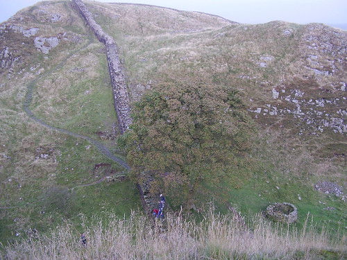
Kevin Costner’s Sycamore Tree. Closer to Carvoran than Nottingham
This small Station, thirty-eight miles from Newcastle, seems to belong rather to the works of Agricola, than to those of Severus; or perhaps it belongs to neither, being about three hundred yards South of the nearest.
The situation of the ground is a valley between two hills. Through this valley, and through the Wall, runs the river Tippal, which opening demanded a security to the pass, as well against the Britons as the Scots. Opposite therefore to Carvoran was erected in after-ages, on the North side of Severus’s Wall, Thirlwell Castle (Thorough Wall) from the Scots breaking through. The situation of Thirlwell Castle is well chosen, upon an elevated round knob of earth. It is the property of the Earl of Carlisle, and far gone in decay.
Here I met with all the civility even friends could bestow. A little beyond is the mark of a Mile castle, ten yards square.
I have now done with desolate mountains, precipices, and climbing stone walls; which have continued more than ten miles.
Half a mile short of Mumps Hall is a hollow in the mountain called Stone Gap, where the Scots broke through. I am now in that part of the Wall which Nature had the least defended; for the river Tippal, mentioned above, falls into the North Tyne. This last running forty miles Eastward, and parallel with the Wall, on the South side, became a kind of guard which prevented the Northern plunderers from penetrating into the country. And, about three miles West of this place, the little surly river Irthing crosses the Wall, and flows into the Eden; which, running Westward to Carlisle about eighteen miles, became an out -guard to the other part of the Wall. The intermediate space of three miles between the North Tyne, aided by the Tippal on the left, and the Irthing feeding the Eden on the right, became a fine opening for plunder.
I now cross a small rivulet called Poltross, which gives me an entrance into Cumberland, being forty-four miles from the Wall’s end, forty and a half from Newcastle, about sixteen and a half from Carlisle, and twenty-nine and a half from Boulness.
The Wall, close to my left, runs along a meadow, is about a yard high, in confusion, has a hedge growing upon it, till it reaches the East bank of the Irthing, where it stops. The West bank is a precipice, which Warburton calls forty yards perpendicular: perhaps he is right. The Wall undoubtedly went to the foot of this hill, and must end there; for the side is too steep, I think, to admit a Wall; but its broken end is visible on the top.
I had this river to cross, and this mountain to ascend; but did not know how to perform either. I effected a passage over the river by the assistance of stones as large as myself, sometimes in, and sometimes out; but with difficulty reached the summit of the precipice by a zig-zag line, through the brambles, with a few scratches.
At the top I had a view of the Wall where it was broken off to the foundation. It measured seven feet exactly.
Links:
—–


Comments